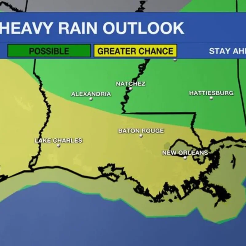
A stalled cold front interacting with deep Gulf moisture is causing severe thunderstorms and an elevated flash flood risk across southern Louisiana from Sunday through Tuesday.
Meteorologists from local weather stations, including FOX8, WAFB, and WBRZ, report that multiple rounds of heavy downpours are expected, potentially leading to rapid water buildup on streets.
Peak Flood Threat on Monday
Monday is forecast to bring the highest risk of flash flooding, with the Weather Prediction Center placing the region under a level 2 Slight Risk for excessive rainfall.
Average rainfall amounts through Tuesday are expected to range between 1 and 4 inches, but localized areas could see totals exceeding 3 to 5 inches where storms repeatedly track over the same communities.
The intense rainfall will be accompanied by frequent vivid lightning and gusty winds, keeping daytime temperatures temporarily cooler in the 80s.
Local authorities advise drivers to monitor weather conditions closely and avoid navigating water-covered roadways, as saturated ground conditions will make flooding develop more easily.
The elevated weather threat is projected to gradually decrease by Wednesday as a drier atmospheric pattern returns to the region.
As rain chances subside late in the week, daytime temperatures are expected to climb back into the low-to-mid 90s, with heat indices potentially approaching official Heat Advisory criteria by Friday.