An underwater Kelvin wave driven by a powerful El Niño has pushed California coastal water levels well above predictions, breaking San Francisco's October record and raising concerns about flooding and erosion.
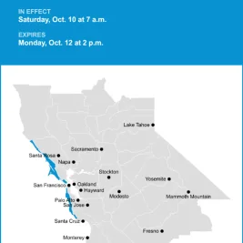
The disturbance reached San Francisco Bay and the Central Coast in October 2026, according to National Weather Service observations.
San Francisco's water levels peaked on October 10 and 11, reaching roughly 1.73 feet above predicted levels on Sunday, Patch reported.
The previous October record stood at about 1.4 feet above normal.
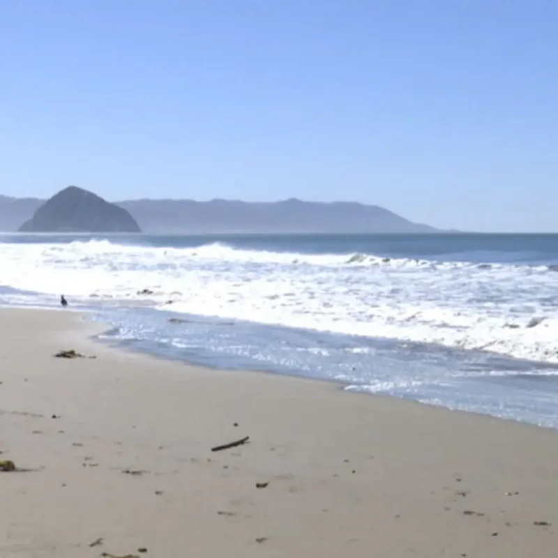
Along the San Luis Obispo County North Coast, measured water levels also exceeded predictions by more than a foot, according to KEYT.
What Drove the Rise
Scientists attribute the elevated water to overlapping factors: the Kelvin wave, warmer ocean water expanding, a persistent marine heat wave, climate change and lingering effects from distant storms.
The San Francisco anomaly began easing by Monday, October 12, potentially as storm-driven swells subsided, according to National Weather Service reporting cited by SFGATE and Patch.
Dillon Amaya, an assistant professor of marine, earth and atmospheric sciences at North Carolina State University, traced the disturbance from the western equatorial Pacific through the Americas and up the West Coast.
"I do think it made it to San Francisco," Amaya told SFGATE.
Amaya said the wave originated in the western equatorial Pacific in August before traveling eastward, reaching South America and moving north along the coasts of Central America and Mexico.
It then entered the Gulf of California before continuing toward California.
"It originated in the western equatorial Pacific in August, propagated along the equatorial strip, ran into South America, moved up the Central American and Mexican coastlines, entered the Gulf of California and moved up the U.
S. West Coast," Amaya said.
The current disturbance is the second major El Niño-related Kelvin wave to reach California waters.
Amaya expects additional waves over the coming months, potentially overlapping with the winter storm season and its larger swells.
"I would expect another 3-4 Kelvin waves over the next several months," Amaya said. "There is already another wave along the Mexican coastline and it should reach U.
S. coastal waters in the next few weeks."
In a separate interview with SFGATE, NASA Jet Propulsion Laboratory senior research scientist Josh Willis explained that the effect is more like a sustained rise in background sea level than a sequence of individual surges.
"I wouldn't think of it as a whole bunch of waves coming, where it goes up and down and up and down," Willis said.
Willis described how the elevated conditions could persist while El Niño remains active.
"It's just going to get high, and it's going to stay high until El Niño goes away," Willis said.
Amaya estimated that the latest wave raised sea levels by about a foot farther south but contributed approximately 6 inches to water levels along California.
Other weather systems make it difficult to isolate the wave's precise contribution to flooding.
"Rachel is also kicking up large swells, which is driving flooding in Long Beach, Newport Beach and other places in Southern California," Amaya said.
Amaya noted that several processes are occurring simultaneously, complicating efforts to determine how much each one contributes to the observed coastal impacts.
"There's a lot of noise right now in the system, so it's hard to unpack exactly what's contributing to what.
It's all evolving at once, so it's hard to peel back the layers," Amaya said.
National Weather Service meteorologist Dylan Fylnn told SFGATE that water levels in San Francisco Bay had been rising over the preceding two weeks.
The agency issued coastal flood advisories and beach hazard warnings as elevated tides threatened low-lying shorelines.
Flynn said the October record reflected multiple influences, including the Kelvin wave, ocean warming, climate change and residual effects from distant storms.
He is also monitoring the highest seasonal tides, known as king tides, expected around Thanksgiving and Christmas.
"If this anomaly hangs around, it's like a guarantee we're going to set the all-time record for the highest tide," Fylnn said.
Flynn warned that the combination of elevated background water levels and severe weather could make the upcoming high tides particularly hazardous.
"And if a strong storm happens to line up with a king tide, the sky's the limit. The worst case scenario could be really, really bad," Flynn said.
Scientists emphasize that a Kelvin wave does not independently produce the kind of sudden inundation associated with a tsunami.
Instead, it raises the ocean's baseline, leaving less room for ordinary high tides, storm surges and large waves before water reaches vulnerable coastal areas.
Michael Jacox, a research oceanographer with NOAA Fisheries, explained that distinction in comments reported by Patch.
"It's not that this Kelvin wave is going to come and flood anything on its own," Jacox said.
Along California's Central Coast, longtime meteorologist John Lindsey said the disturbance had reached the region the previous week.
He described an approximately 6-mile-per-hour progression, covering roughly 150 miles per day, consistent with the observed rise in coastal water levels.
"We are currently now in a very strong El Niño event and this particular condition is strengthening as we speak," Lindsey said.
Lindsey also cited an approximately 83% chance that the event could become the strongest El Niño recorded since 1950.
At Port San Luis, observed tides reached approximately 1.3 feet above predictions during the recent period of elevated water levels.
"We actually got about 1.3 feet higher than predicted tides," Lindsey said.
Lindsey explained that the difference between predicted and observed tides can substantially affect coastal conditions, particularly when high and low tides both occur at higher-than-expected levels.
"Predicted tides are the differentials and gravitational forces between the sun and the moon and the Earth and it's a pretty complex equation to come up with the predicted tides, but the actual tide levels are measured at Port San Luis at the NOAA tide station," Lindsey said.
"At one time those got about 1.3 feet higher than predicted. Consequently the low tides are much, much higher and the high tides were especially much higher."
"Last week, we were seeing tides predicted at about 5.8 feet and they actually came in at about 7.1 feet and those are some of the highest tides you would see all year long," Lindsey said.
Erosion and Flooding Risks
The risks extend beyond California.
Reporting by the Chinook Observer cited U. S.
Geological Survey research oceanographer Sean Vitousek, who warned that elevated sea levels combined with larger North Pacific swells and unusually high tides could accelerate West Coast erosion.
Previous major El Niño events in 1982-83, 1997-98 and 2015-16 were also associated with severe beach erosion.
Deputy State Climatologist Karin Bumbaco told KNKX Public Radio that communities already experiencing winter flooding could face more frequent incidents during the current season.
"If you see flooding regularly in winter, it would likely be more frequent this winter," Bumbaco said.
George Kaminsky, a coastal engineer with Washington state's Department of Ecology, described the speed at which Kelvin waves can alter coastal water levels.
"Rather than a few millimeters a year, we're getting a foot within a few weeks. So it can be really interesting and can be really scary," Kaminsky said.
On California's Central Coast, residents have also noticed changes in wave behavior.
Kolea Quincey, who lives near the water in Baywood Park, described the stronger-looking surf and water reaching farther along the shoreline.
"It just feels bigger," Quincey said.
Quincey said the waves appeared to be reaching people walking along the coast more readily than usual.
"It's like the waves are crashing and coming up higher and actually spraying on people on their walk, so I have noticed that.
It just feels more powerful," Quincey said.
Lindsey warned that simultaneous high tides, elevated sea levels, storm runoff, storm surge and powerful waves could cause substantial disruption in San Luis Obispo, Santa Barbara and Ventura counties.
"Worst case scenario, if we were in the middle of the king tide, and we had a Kelvin wave, and we had storm runoff and storm surge and high waves, there's potential for a lot of disruptions and a lot of damage throughout the county," Lindsey said.
Lindsey emphasized the importance of preparing for the approaching El Niño-driven coastal conditions.
"That's why it's so important to be prepared for this upcoming El Niño," Lindsey said.
The next major king tides are expected around Thanksgiving and Christmas, when high astronomical tides could coincide with additional Kelvin waves and winter storms.
In Southwest Washington, predictions cited by the Chinook Observer place a high tide of 9.42 feet at the North Jetty entrance to the Columbia River on November 25, while Raymond inside Willapa Bay is forecast to reach 12.46 feet that day.