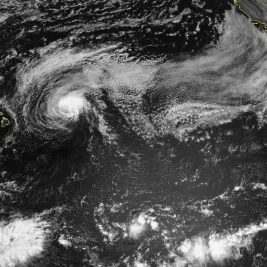
The National Weather Service issued a warning on June 27, 2026, about a dangerous and prolonged heat wave expected to bring triple-digit heat indices and record-breaking temperatures across the Central and Eastern United States through the Independence Day holiday.
Forecasters have high confidence that extreme heat risks will expand significantly between July 3 and July 9, potentially forming an Omega block-like atmospheric pattern.
In contrast, the Northwest and Rocky Mountain regions are projected to experience well below-normal temperatures, including possible high-elevation snow.
Heat Wave to Intensify and Spread Eastward
The enduring weather pattern is expected to take hold over the June 27-28 weekend before intensifying and spreading into the Eastern US by the middle of the following week.
Frank Pereira, a meteorologist at the Weather Prediction Center, noted a strong contrast in temperatures between the cooler Rockies and Northwest and the hotter Central and Eastern regions.
Temperatures are anticipated to rise significantly, pushing feels-like conditions well past normal summer thresholds for millions of residents east of the Rockies.
Pereira told USA TODAY on June 26 that conditions will be quite toasty and well above normal through next week, really starting to ramp up in the Eastern US by midweek.
Major metropolitan areas from the Ohio Valley into the mid-Atlantic and Northeast are expected to see historical temperature milestones surpassed as early as late June.
Pereira stated that on June 30 and July 1, records will start to fall from the Ohio Valley into the mid-Atlantic and Northeast.
The extreme weather is expected to peak just before the holiday weekend, expanding the zone of triple-digit temperatures further north.
By Thursday, July 2, temperatures in the triple digits are expected from the Carolinas northward through the mid-Atlantic, including Washington, D.
C. , according to Pereira.
High humidity levels will accompany the high temperatures, severely worsening outdoor conditions from the Dakotas eastward.
Pereira noted that it will not cool off much at night, with elevated nighttime temperatures preventing urban structures from cooling down and amplifying the risk of heat-related illnesses.
Meteorologists expressed concern over widespread overnight warm low temperature records.
The lack of overnight relief poses a direct threat to vulnerable demographics, including the elderly and individuals lacking adequate cooling systems.
Pereira advised limiting outdoor activity if possible.
For those who must go outside, he emphasized taking frequent breaks, staying hydrated, checking car back seats, and monitoring vulnerable populations.
A forecast discussion from the Raleigh National Weather Service office on June 26 warned to begin preparations now for potential highs possibly over 100°F for three to four consecutive days.
The National Oceanic and Atmospheric Administration projected that on July 3 and 4, areas including the Mississippi, Ohio, and Tennessee Valleys, Great Lakes, Appalachians, Mid-Atlantic, and Southeast will face high to moderate risks of extreme heat.
AccuWeather reported that many people will enjoy favorable conditions for parades, cookouts, and fireworks, though scattered thunderstorms may interrupt festivities across parts of the Great Lakes and Northeast.