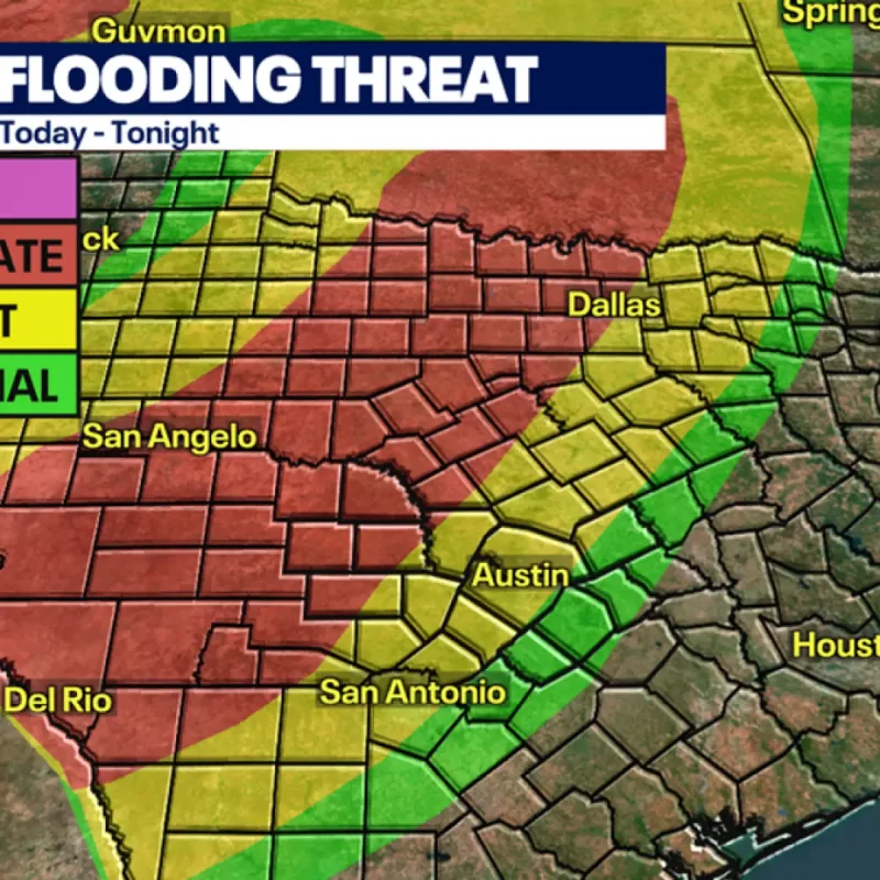
Flood watches have been issued across Central and North Texas through Friday morning as multiple atmospheric disturbances collide with tropical moisture.
The National Weather Service and local forecasting teams warn of severe weather and localized surface flooding.
Slow-moving frontal boundaries are expected to generate successive storm clusters across the region.
Rainfall accumulations are forecast to average between 2 and 4 inches, with isolated pockets reaching up to 6 inches.
Two Rounds of Storms Expected in Central Texas
Central Texas will see two distinct rounds of stormy weather, starting with early scattered thunderstorms.
Conditions will then transition into widespread downpours, strong winds, and small hail later in the day.
In North Texas, showers initially developing along Interstate 35W will intensify overnight.
Excessively dry ground conditions increase the risk of rapid runoff and flash flooding across municipal areas.
A stronger cold front sweeping through the state on Friday is projected to diminish the rainfall.
The front will also bring noticeably cooler temperatures, lowering weekend highs into the upper 70s and lower 80s.