The 2026 hurricane season has delivered a striking contrast between the Atlantic and Pacific basins, with a record-breaking El Niño as the primary driver.
As of late September, the Atlantic has yet to produce a single hurricane, while the Pacific has already generated 18 tropical storms and hurricanes, including eight hurricanes.
Atlantic Stays Unusually Calm
Only seven named tropical storms have formed in the Atlantic this year, and none have reached hurricane strength.
Former National Hurricane Center specialist Stacy Stewart, now a meteorology teacher, said El Niño is a major factor but not the only cause.
She pointed to drought conditions in Ethiopia, dry air, and Saharan dust as additional suppressors of storm development.
"Many tropical waves originate over the Ethiopian Highlands," Stewart said.
"Waves that form there usually have a higher chance to become hurricanes, but this year, drought limited the storm clusters needed to sustain development across the Atlantic."
Phil Klotzbach of Colorado State University described the Atlantic season as one of the quietest since reliable records began in 1950.
He noted that high vertical wind shear across the tropical Atlantic has repeatedly disrupted storm formation.
"The last time we went this long without an Atlantic hurricane was in 1914," Klotzbach said.
"The accumulated cyclone energy in the Atlantic is around nine this season, far below the usual 88 by late September."
Tropical Depression Fay, the longest-lived storm in the Atlantic this season, remains weak amid hostile wind shear and dry air, with no threat to land.
Invest 91L, an area of low pressure in the central subtropical Atlantic, has shown signs of development but lacks closed circulation needed to become a tropical depression.
The National Hurricane Center expects it to potentially become Tropical Storm Hannah soon but does not forecast it to reach hurricane strength.
Pacific Hyperactive with Powerful Storms
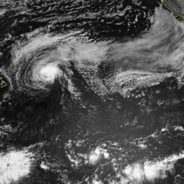
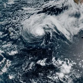
In the Pacific, the season remains very active, with Hurricanes Polo and Nolo, along with Tropical Storm Rachel, currently tracking with significant intensity.
Nolo, now a Category 4 hurricane, is passing south of Hawaii, which has faced three hurricane threats this year.
"Hurricane Polo intensified from a tropical storm to a Category 5 hurricane in less than 24 hours," said Gabriel Vecchi, Princeton University geosciences professor, describing the rapid intensification as "astounding."
Assistant Professor Kelly Nuñez Ocasio of Texas A&M University noted that tropical waves from Africa often cross into the Atlantic and sometimes the Pacific, where favorable conditions can strengthen them into hurricanes.
"This summer, some Pacific hurricanes like Fausto and Genevieve developed from weather disturbances that traveled across Africa and Central America into the eastern Pacific," Stewart added.
Brian McNoldy, a senior research associate at the University of Miami, stated that the current El Niño is expected to be the strongest on record, fueling warm Pacific waters and more powerful storms.
"We are headed toward what will almost certainly be the strongest El Niño on record," McNoldy said. "It has exceeded expectations in both the Pacific and Atlantic basins."
These developments illustrate how El Niño, combined with regional drought and atmospheric conditions, has created a season of contrasting activity between two major hurricane basins.