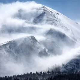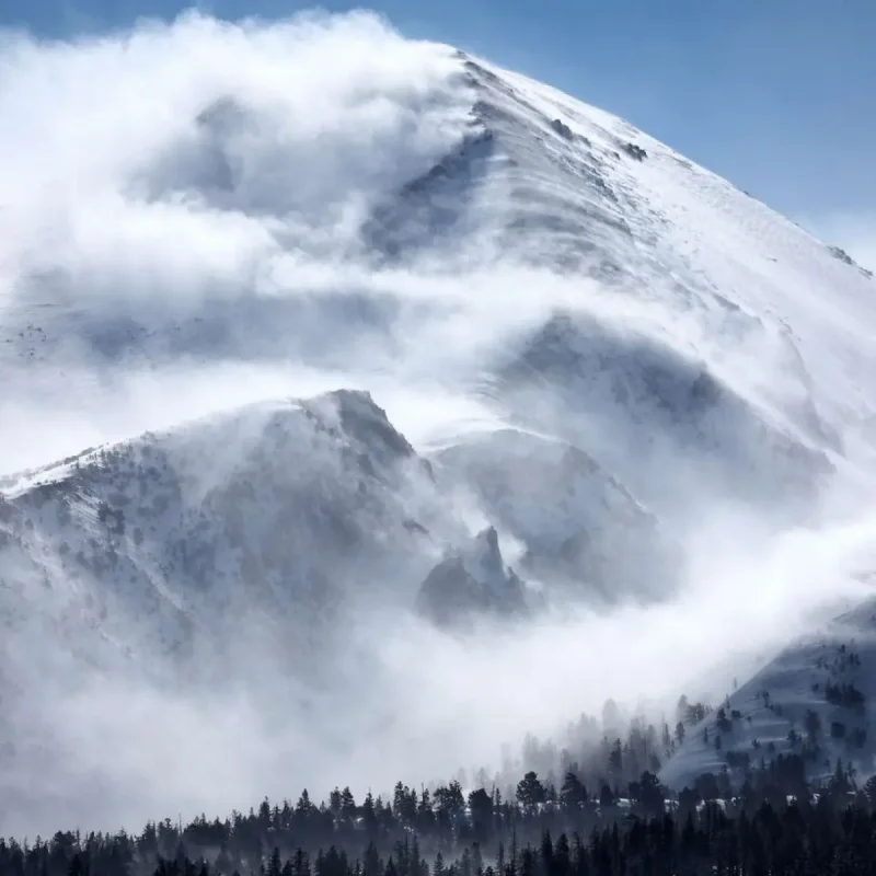
An unseasonably cold Pacific weather system brought significant snowfall and heavy rain to the northern Rocky Mountains on Monday, June 29, 2026.
The eastern United States, meanwhile, prepared for a severe July Fourth week heatwave.
>>> Jack Draper Withdraws From Wimbledon Due to Recurrent Arm Injury
The National Weather Service issued winter storm and weather alerts across portions of Idaho, Montana, and Wyoming.
Temperatures plunged 15 to 20 degrees Fahrenheit below normal.
The unseasonal cold front pushed the summer snow line down to 1,800 meters, threatening to disrupt holiday travel with heavy, wet snow and wind gusts exceeding 50 mph.
Forecasters warned that the combination of cold temperatures, gusty winds, and dense snow created hazardous backcountry conditions.
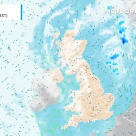
According to the National Weather Service, regional accumulations could reach up to 12 inches in the highest elevations of Montana, while Idaho's Fourth of July peak anticipated up to 6 inches.
The agency also noted that the system brought widespread rain, with totals between 0.25 and 1.00 inch across Missoula, Montana, alongside a flash flood risk in Glacier National Park.
Concurrently, the leading edge of the front triggered lightning strikes, worsening wildfire dangers across drought-stricken areas in Utah, Colorado, and Arizona.
In contrast, forecast models indicated that a developing heatwave will push temperatures into the high 30s Celsius across the Midwest and Northeast by Thursday.
Cities such as New York, Philadelphia, and Washington DC are projected to reach 40 degrees Celsius, approaching historical record highs right before the holiday weekend.